Remote Sensing Technicians
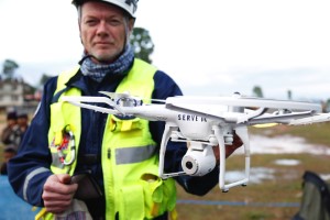
Remote sensing technicians in the geosciences use specialized equipment
to collect and analyze data from the Earth’s surface, atmosphere, and
oceans. They typically work with scientists and engineers to operate
remote sensing instruments, such as satellite imagery, aerial
photographs, and radar systems. Their duties require a moderate
background in the geosciences and may include:
-
Calibrating and maintaining remote sensing equipment.
-
Processing and analyzing images and other data to identify
geological features, environmental conditions, and human-made
structures.
-
Interpreting the results of their analysis to support scientific
research or engineering projects.
-
Preparing reports and presentations to communicate their findings to
others.
Read more about this occupation on O*NET OnLine at www.onetonline.org/link/summary/19-4099.03
Explore related careers